Reverse geocoding allows you to select a new location on the map and then use that latitude and longitude to access the location’s street address and geocode it.
To reverse geocode a location:
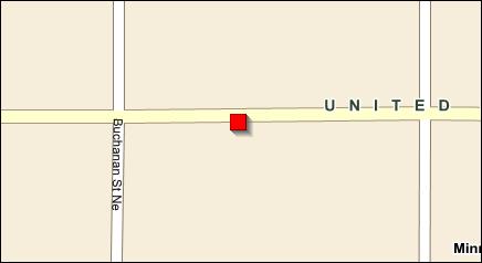
1 From the Route Detail quadrant, right-click on a stop and select View Advanced Geocode.
On the map, the current location displays as a red square.
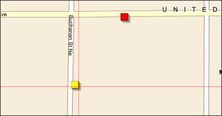
2 On the map, right-click on the new location.
A yellow square notates the new location.
The new latitude and longitude are displayed under Alternate Location.
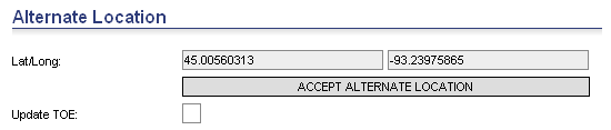
3 Click Accept Alternate Location.
4 Click Reverse Geocode.
The new location’s street information is displayed under Geocode Results.
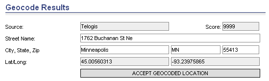
5 Click Accept Geocoded Location.
The new location is now the original location.
6 Click Save or Save and Go Back.
![]()