Using a user configured distance tolerance, geofencing can be applied at the Route level to monitor when a Route is getting outside of its planned trajectory.
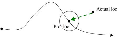
A vehicle violates a route geofence when its last reported latitude/longitude (GPS message) lies outside of its projected Geofence.
· Projected Geofence is an imaginary circle centered at a Projected Vehicle Location at the time of the reported GPS.
· Projected Vehicle Location is calculated based on the elapsed time from the last visited stop and where it is supposed to be given the last reported date/time of the GPS message.
· The radius of the imaginary circle is set in the Configuration page described in the Configuring Geofencing section.
The Descartes Route Planner user interface (UI) displays a green animated arrow from the Last Reported Vehicle Location to the Projected Vehicle Location.
In Descartes Route Planner:
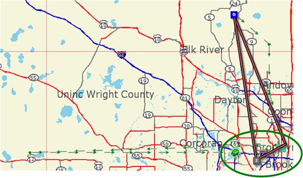
![]() Note&emdash; Users can choose
to show or hide the last reported longitude/latitude by right clicking
on a route and selecting Show/Clear All
Last Known Locations.
Note&emdash; Users can choose
to show or hide the last reported longitude/latitude by right clicking
on a route and selecting Show/Clear All
Last Known Locations.
