Geocoding Locations are important because Descartes Routing and Scheduling makes Route calculations based on the latitude and longitude rather than the actual physical address.
To view an existing Location’s Geocode:
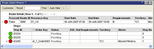
1 From the Route Detail page, click the + to expand the route details.
2 Right-click on a Stop and and select View Geocode.
The Geocode Results page appears.
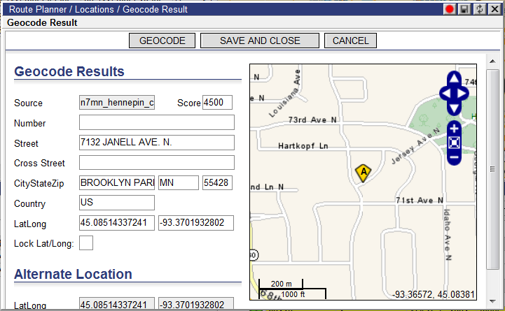
Users can also opt to update the Transport Order Entry System at the same time by checking the Update TOE checkbox.
Or,
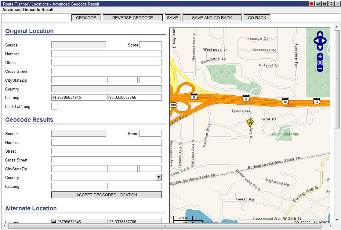
Right-click on a stop and select View Advanced Geocode.
The Advanced Geocode Result page appears.
![]()